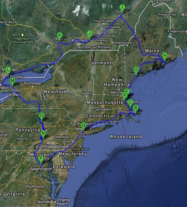
Travel Map
13 days on the east coast – A summary
Finally I found some time to summarize our holiday trip along the East Cost of the United States and Canada.
Within 13 days, we traveled about 4300 kilometers.

On this journey we passed about 10 US states:
– Connecticut (New Haven)
– Delaware (on the trip from Washington D.C. to New York City)
– Maine ( Bar Harbor, Bangor, Ellsworth, Portland, Rockland, Skowhegan)
– Massachussets (Boston, Hyannis, Peabody, Plymouth, Salem)
– Maryland (on the trip from Washington D.C. to New York City)
– New York (New York City, Niagara Falls)
– Pennsylvania (Gettysburg, Harrisburg)
– Rhode Island (Newport)
– Virginia (Charlottesville, Fredericksburg, Jamestown, Richmond, Shenandoah National Park, Williamsburg)
– West Virginia (Harpers Ferry)
…as well as the following canadian provinces:
– Ontario (Niagara Falls, Toronto)
– Quebéc (Montréal, Québec)
All in all, it was a great time!